How to Determine UPS Domestic Shipping Zones
 If you don’t opt for flat-rate shipping, which has a set price, the cost of shipping a package within the United States will vary based on several factors like the distance it needs to travel. To simplify measuring the distance between the points of origin and destination, many carriers use shipping zones. In this article, we’ll going to focus on UPS domestic shipping zones.
Shipping zones are geographic areas that postal and courier companies use to determine estimated delivery times and prices. The number of the shipping zone for a particular shipment depends on the origin and destination ZIP Codes: the farther the point of destination, the higher the shipping zone number and the longer your package will take to arrive. The shipping zone also affects shipping costs: the greater the distance, the higher the shipping fee.
Different carriers use different shipping zone systems. For example, the United States Postal Service has nine shipping zones based on the shipping radius, ranging from 50 miles for Zone 1 to 1081+ miles for Zone 8, and Zone 9 includes US territories and Freely Associated States. These zones are used for three USPS services: USPS Ground Advantage, Priority Mail, and Priority Mail Express.
UPS is a courier company that prioritizes delivery spead regardless of distance, but it still uses shipping zones for its less speedy and more affordable ground service. UPS Ground is a cost-effective, reliable ground delivery method with estimated delivery times ranging from one to five business days depending on the distance, i.e. shipping zone. But how to determine the UPS domestic shipping zone for your package?
To make things easier for customers, UPS has a shipping zone calculator called U.S. Ground Maps. It generates full-color United States maps that illustrate estimated delivery times for ground delivery from or to the chosen ZIP Code to all 50 states and Puerto Rico. All you need to do to generate a time-in-transit map is choose the shipping date (since UPS Ground only delivers on business days, they need to know when exactly you intend to have your package shipped in order to provide estimated delivery time) and enter the origin or destination ZIP Code.
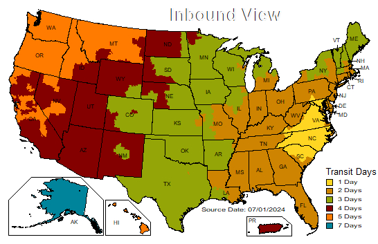
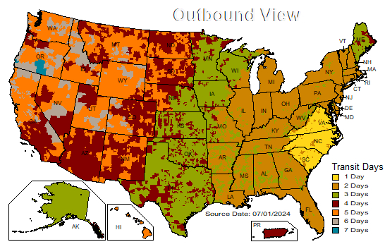
Once you click Submit, UPS will generate a time-in-transit map for the specified origin (outbound view) or destination (inbound view) ZIP Code, with color-coded delivery times ranging from 1 to 7 days. While UPS Ground are normally delivered within 1 to 5 business days, delivery to remote or rural areas may require additional delivery days.

UPS U.S. Ground Map sample, inbound view

UPS U.S. Ground Map sample, outbound view
If you want to determine the shipping zone for a pair of ZIP Codes, you can generate and download a UPS Zone Chart. Enter the origin ZIP Code, click Download Chart, and save the resulting Excel file on your device. In the chart, you will find a list of shipping zones for the selected ZIP Code for various UPS services: Ground, 3 Day Select, 2nd Day Air, 2nd Day Air A.M., Next Day Air Saver, and Next Day Air.